

Visit the Dunedin Chinese Garden with photographer Trev Hill.
Read MoreScenic walks in Dunedin: Mt Cargill to The Organ Pipes
Getting There:
Mt Cargill is an easy 10 minute drive from the central city. Access is gained via Cowan Rd, be careful to dodge the pot holes on the ungraded road. The starting point of the walk is beside the signal tower and is 676m in elevation. There is a poorly sign-posted parking area just prior to the summit, but I always drive past it and park up under the signal tower.
View from Mt Cargill out beyond Butters Peak to the Otago Harbour and Otago Peninsula.
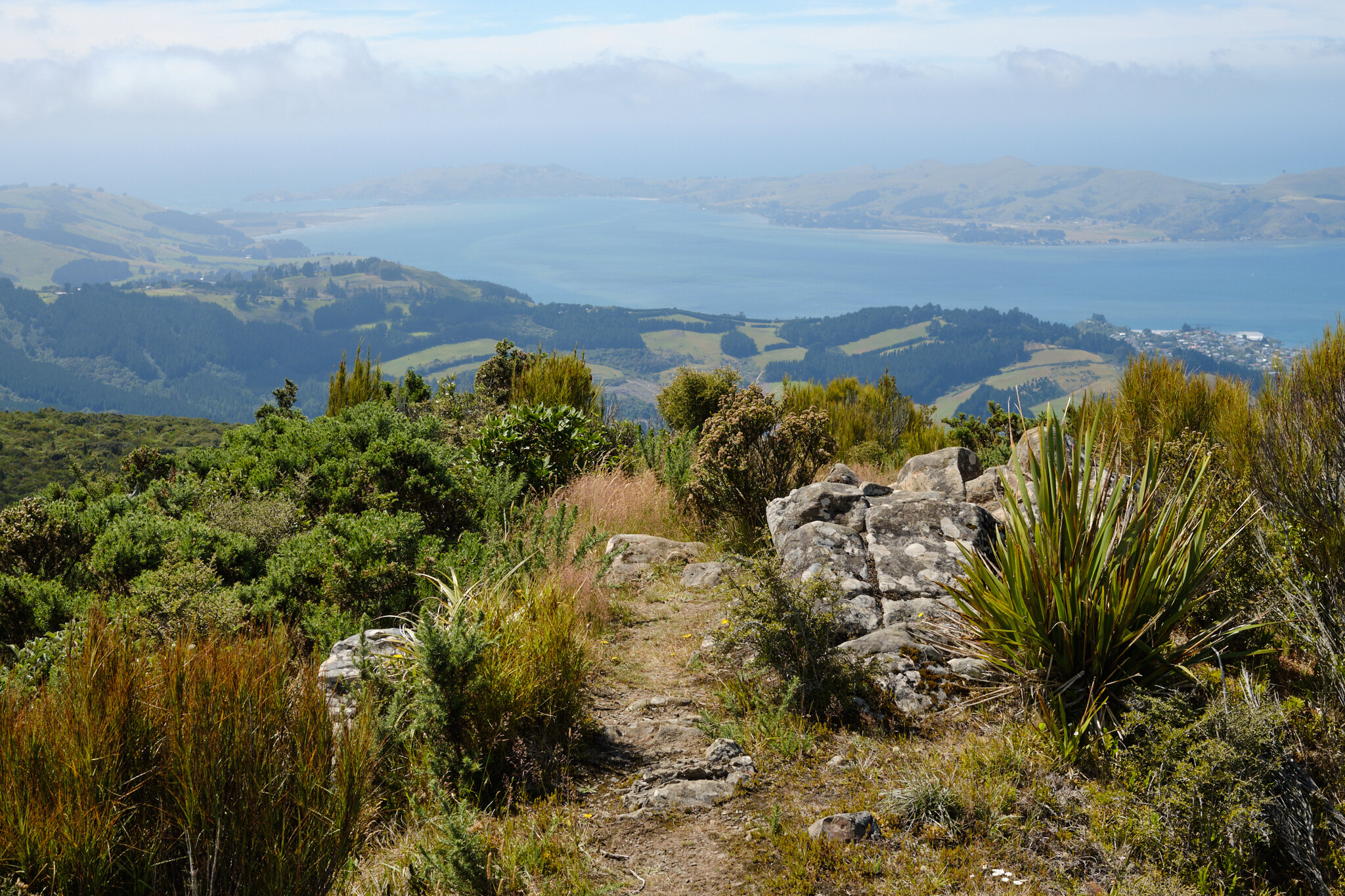
View from start of walk from Mt Cargill to Organ Pipes. Plenty of haze in the air on this warm sunny day in Dunedin.
The walk:
The walking track starts near the signal tower and is easy to follow. Follow the path toward Butters Peak. Butters Peak is an excellent place to stop, but as I was returning the same way I decided to visit it on the way back. Just keep walking past Butters Peak. I have been spending a bit of time in the Catlins recently so have been a bit spoilt with stunning rainforest bush. The bush on this walk is not on the same level, rather more dry and spindly in character. After about 30 minutes walk you will arrive at the Organ Pipes
The distinctive Organ Pipes of Dunedin.
The Organ Pipes are a fascinating geological feature, and are fun rocks to climb over. Scramble up them and find some good spots to enjoy the view and take a break from the hectic pace of the world.
Organ Pipes, Dunedin, NZ.

Organ Pipes, Dunedin, NZ.
The walk back is more or less slightly uphill. So, stopping at Butters peak for a breather is highly recommended. The views from Butters Peak are sensational and I rate this location as one of my favourite places in Dunedin.
View of Blue Skin Bay and Karitane from Butters Peak.
View of Otago Harbour and the Otago Peninsula from Butters Peak.
View from Butters Peak to the Otago Peninsula.

Butters Peak rock formation.
View from Butters Peak to Mt Cargill and the signal tower where the walk started.
The walk back to Mt Cargill takes about 20 minutes and is mostly uphill. I just like to think of it as a nice bit of exercise.
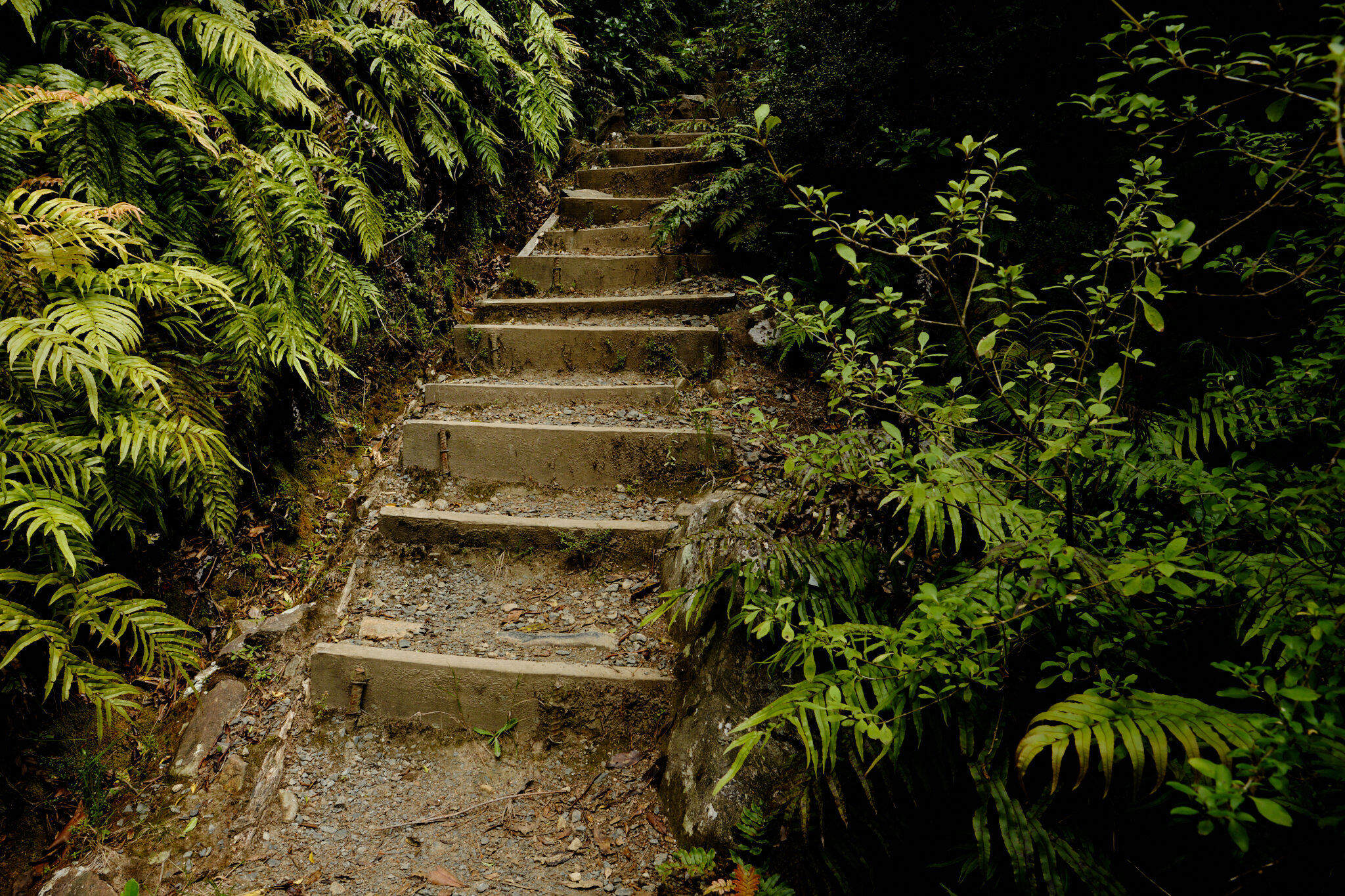
Handsome looking steps are part of the last push to reach the summit of Mt Cargill.
Back to the start again, Mt Cargill signal tower.
The Mt Cargill to Organ Pipe walk is a nice way to spend a couple of hours in Dunedin. Another great day out in Dunedin.


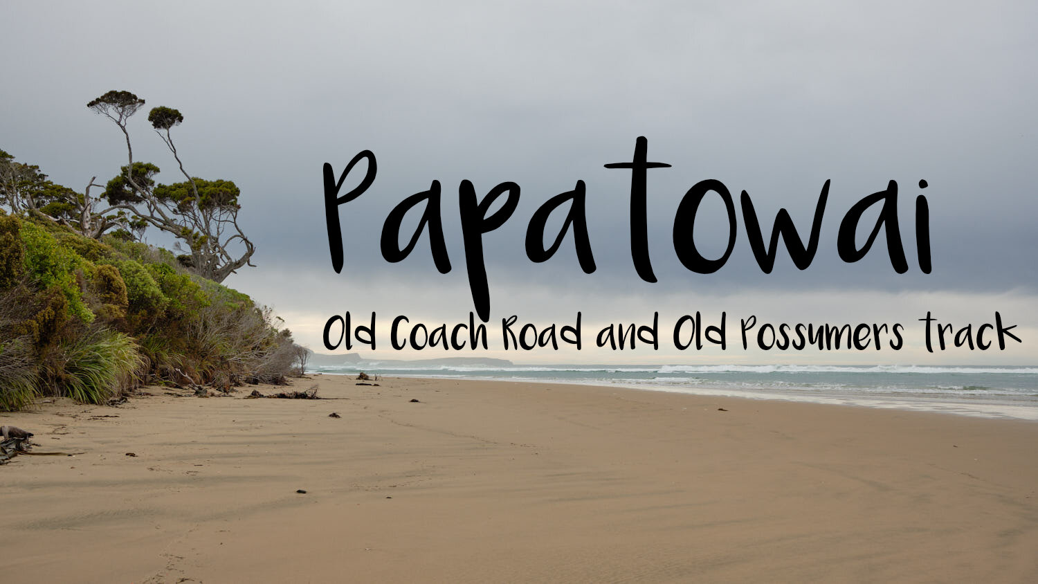


Papatowai: Old Coach Road & Old Possumers Track
Discovering Papatowai
I was driving through Papatowai in the Catlins recently when I noticed the sign for ‘Beach’ and decided it was worth investigating. After a short walk from my car, the beach view I witnessed was nothing short of epic. The place name Papatowai means where the forest meets the sea, it did, and it was breathtaking. I haven’t seen anything like it before in New Zealand, and I was completely mesmerised.
Tahakopa beach, Papatowai, Catlins, Otago.
Tahakopa beach, Papatowai, Catlins, Otago.
Tahakopa River, Catlins, Otago, NZ.
I wanted to explore the forest before me, but that adventure would wait for another day. As I was driving home I noticed on the north side of the Papatowai bridge a walking track. Bingo.
PART 1: OLD COACH ROAD
The track I saw from my car is called Old Coach Road. It is a historic track and like the name suggests, the road was used to coach people and supplies by horse from boats in the old days. The track is excellent and immediately I was engaged by the surrounding bush.
Old Coach Road Track, Papatowai, Catlins, Otago, NZ.
Old Coach Road Track, Papatowai, Catlins, Otago, NZ.
The Old Coach Road stays close to the edge of the beach. The historic road is wide and an easy meandering walk. I loved the abundance of ferns on the forest floor, and compared with other bush walks I have been on, a lot less chaotic to photograph.
Old Coach Road, Papatowai, Catlins, NZ.
Old Coach Road, Papatowai, Catlins, NZ.
Old Coach Road Track, Papatowai, Catlins, Otago, NZ.
Eventually Old Coach road follows to the edge of the forest and you can see out beyond to the Tahakopa river.
Old Coach Road Track, Papatowai, Catlins, Otago, NZ.
PART 2: TAHAKOPA BEACH
Emerging out onto Tahakopa beach is a real treat. Looking at how the forest meets the sea is fascinating. I had bumped into a local earlier on the track who told me the marker for Old Possumers track was about three quarters the way down the beach toward the cliffs. So off I went photographing everything!
Tahakopa Beach, Papatowai, Catlins, Otago, NZ.
Tahakopa Beach, Papatowai, Catlins, Otago, NZ.
Tahakopa Beach, Papatowai, Catlins, Otago, NZ.
Tahakopa Beach, Papatowai, Catlins, Otago, NZ.
Tahakopa Beach, Papatowai, Catlins, Otago, NZ.
There are plenty of washed up or uprooted tree trunks to compose images with on the beach. The day was overcast, and no light was kicking off but it was still loads of fun. My favourite image from the day is below.
Tahakopa Beach, Papatowai, Catlins, Otago, NZ.
PART 3: OLD POSSUMERS TRACK
Finding the orange triangle marker for the Old Possumers track requires a bit of careful looking and a small dose of luck. I was climbing up the sand bank along the beach quite a fair bit to take photographs, so it was a nice surprise to accidently stumble across the marker.
Tahakopa Beach, Papatowai, Catlins, Otago, NZ.
Once on Old Possumers track it was quickly back down into the bush, but not before I got one more image of these two wind swept trees overlooking the beach.
Old Possumers Track, Papatowai, Catlins, Otago, NZ.
Old Possumers track is well marked with the orange arrows to guide the way. When I visited 2 large trees had fallen over the path, but apart from those obstacles it was easy to follow.
Old Possumers track, Papatowai, Catlins, Otago, NZ.
Old Possumers track, Papatowai, Catlins, Otago, NZ.
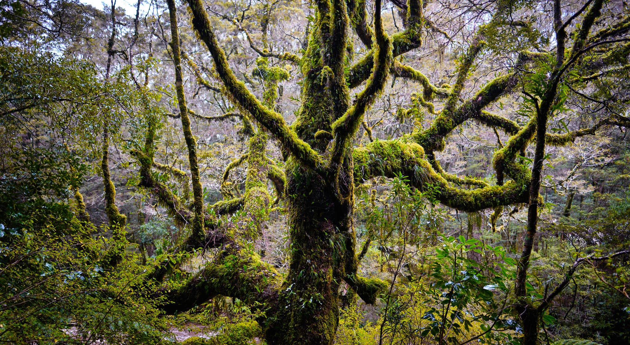
I thought I would take a couple of detail images of vegetation on the track.
Old Possumers track, Papatowai, Catlins, Otago, NZ.
Old Possumers track, Papatowai, Catlins, Otago, NZ.
Old Possumers track, Papatowai, Catlins, Otago, NZ.
Old Possumers track, Papatowai, Catlins, Otago, NZ.
As always in NZ, follow the orange arrows.
Old Possumers track, Papatowai, Catlins, Otago, NZ.
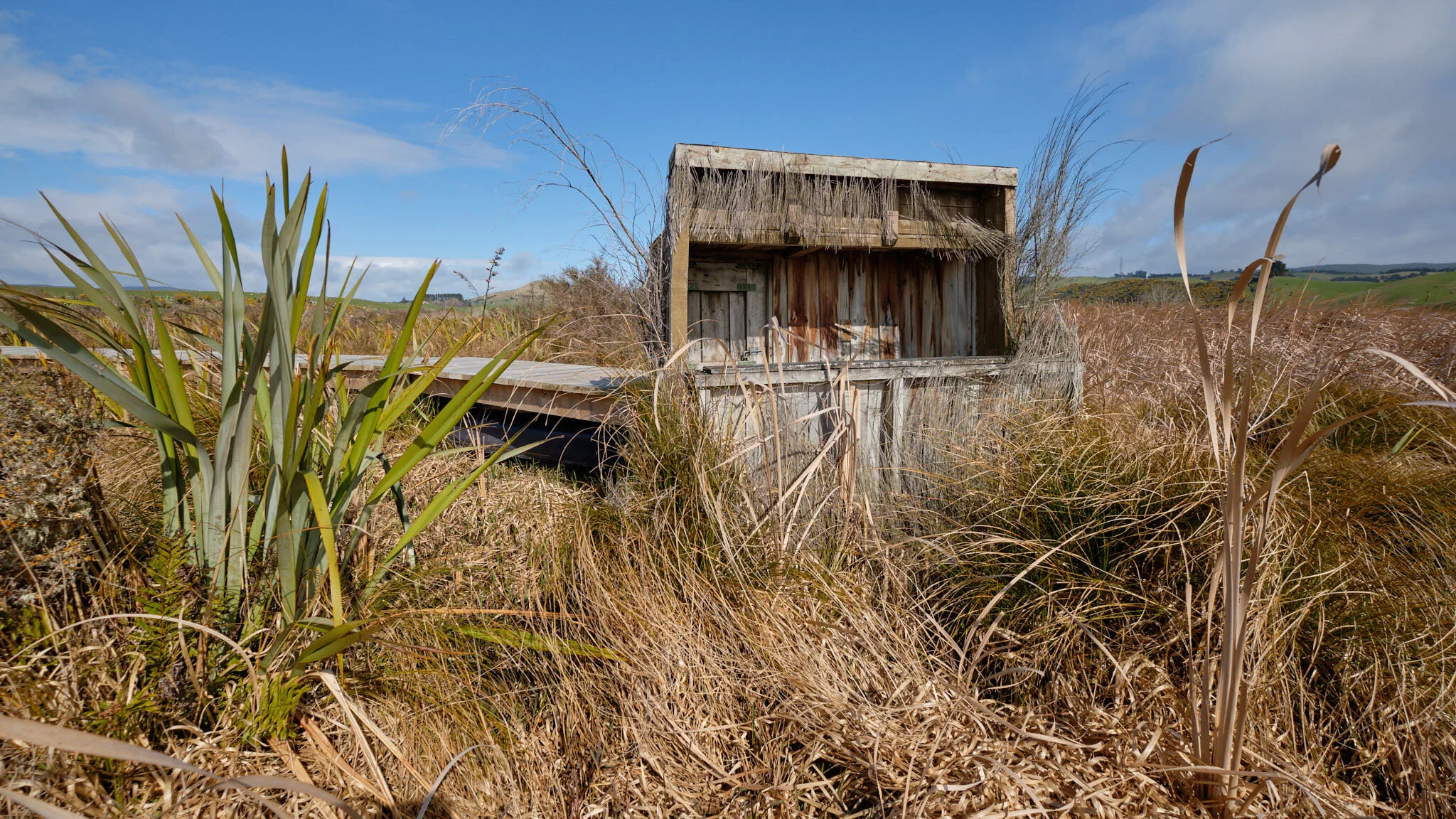
The image below here was taken walking over a swampy bog on an elevated wooden pathway.
Old Possumers track, Papatowai, Catlins, Otago, NZ.
On a very windy day, I’d be tempted to avoid walking Old Possumers track, there are more than a few fallen trees around.
Old Possumers track, Papatowai, Catlins, Otago, NZ.
Old Possumers track has been beautifully crafted by the Department of Conservation, down below is an example of a walkway to help you walk through some of the boggy terrain, although be careful not to slip on the logs.
Old Possumers Track, Papatowai, Catlins, Otago, NZ.
Old Possumers track, Papatowai, Catlins, Otago, NZ.
I finished the Old Coach Road and Old Possumers track in about 4 hours. However, I spent a long time documenting the journey with my camera. From a photographers perspective this adventure was amazing. There are so many photo opportunities at Papatowai, it really is a dream location. I would say Old Coach Road is achievable for most peoples fitness levels, but the uneven terrain of Old Possumers Track is more suited to sure-footed people who can avoid twisting an ankle with the odd slippery log on the pathway here and there.
In summary this is the best bush walk I have experienced in the Catlins, or anywhere for that matter. I can’t wait to do it again.


Waipohatu walking track and waterfalls
I’m a big fan of the Catlins. As a landscape photographer I feel it offers plenty of locations for interesting photography. I’m not sure I love waterfalls all that much, but, I really enjoy walking through pristine New Zealand native bush. In the case of the Waipohatu walking track, you not only get a lovely bush walk but two waterfalls to photograph. How could I resist.
Getting There
The Waipohatu walking track is located on the way to Curio Bay. Just take a detour toward Slope Point and then drive up Waipohatu Rd when it pops up on your right. I parked up at the picnic spot (with toilet) and started my walk from there.
Trees near where I parked my car on the Waipohatu walking track.
Stage One: A gentle stroll.
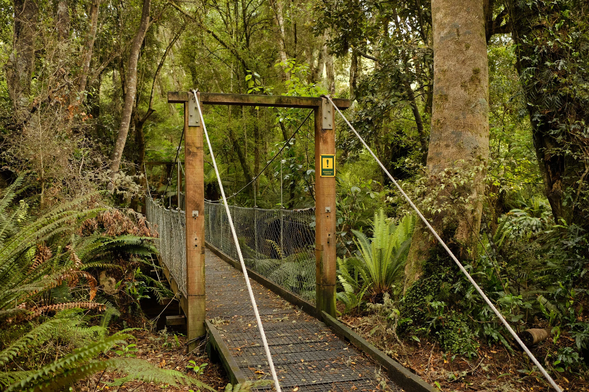
The first part of the walk includes the most photogenic bush of the adventure. The walk has been designed to accommodate wheelchair access so is very well constructed. I was very taken with this suspension bridge.
No more than 5 at a time over this suspension bridge.
The pathway was wide and user friendly with lovely large trees lining the route.
Waipohatu walking track.
Stage Two: An uphill slog.
After walking through the easy meandering track you come to a picnic area and then move on to the next part of the track. From this point the track becomes much more challenging. The track has plenty of tree roots, so watch your footing.
Follow the orange arrows on the Waipohatu walking track.
The track follows along a stream and eventually you get to cross it on this rather cool bridge.
After crossing the bridge the track climbs fairly steeply. if you have average fitness you should be fine, but it definitely got my heart rate going.
Stage 3: Waterfalls
After climbing for a while the track eventually flattens out and then dips down again toward the waterfalls. You will come to a juncture where you can go left or right. Both tracks lead to a waterfall. It has to be said that 2 for the price of one is always an attractive deal. I went right to the upper falls first.
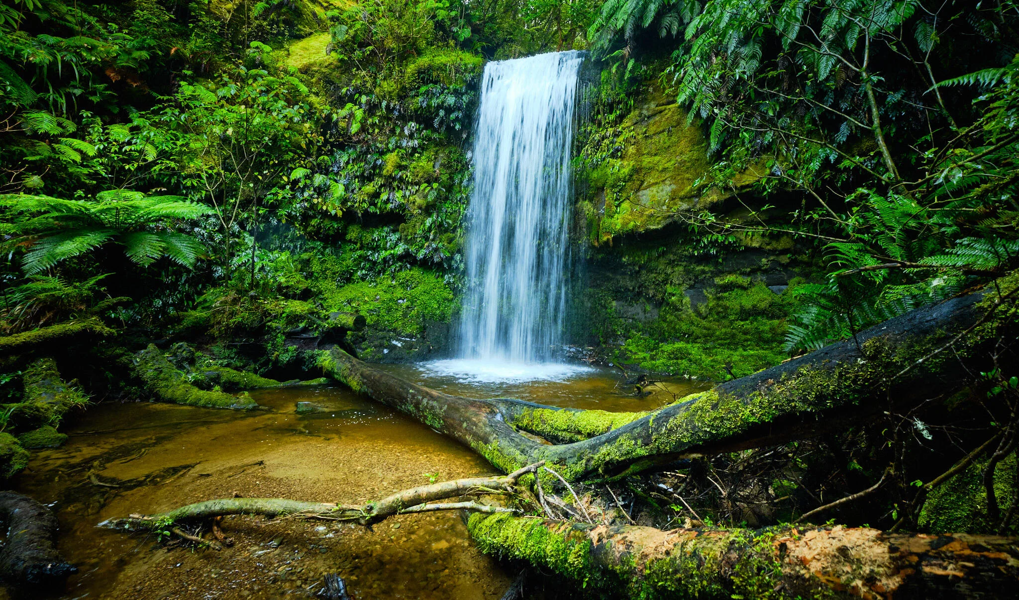
Waipohatu waterfall, Catlins, Otago, NZ.
The lower falls are really nice. A bit tricky for navigating the area, but that’s half the fun. I took a couple of images of the waterfall. In one I used the stunning ferns in the foreground to add depth. The image shows the young fronds coming through the centre of the plant creating the beautiful koru shape found in traditional Maori culture.
Waipohatu waterfall, Catlins, Otago, NZ
Waipohatu waterfall, Catlins, Otago, NZ.
The trip out of the bush, was a lot faster as it was downhill for the first part. The DOC signs estimate about 2 hours for the walking, and seemed about right. All in all the Waipohatu walking track is a lovely day out. If you have reasonable fitness and are coordinated enough to navigate an uneven track with sludge and tree roots you should be fine.